Competence of graduates
Every graduate of the Geomatics Technology D-III Study Program has the following competencies:
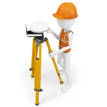
- Determine the global satellite observation position of the Global Navigation Satellite System (GNSS)
- Correction of geometric digital image
- Perform the acquisition of remote sensing and help / supporting data
- Do the process of giving a map coordinate system
- Develop a field survey plan
- Collect secondary data: population, social, and economic data Read More..
Graduates profile
Profile of graduating from the D3 Geomatics Technology Study Program is based on 3 things, namely (1) KKNI Level, (2) SKKNI Geospatial Information in 2020, and (3) The results of the survey of industrial needs.
| Level | Graduation Profile | |||||
|---|---|---|---|---|---|---|
| Terrestrous survey | Hydrographic survey | Remote sensing | Photogrammetry | SIG | Cartographer | |
| D3 Level 5 | Terrestrous Survey Technician | Hydrographic techicles | Middle Technician remote sensing | Techni Photogrammetry | Mapping technicians and sig surveyors of the representation | - |
D3 graduate profile
-
Terrestrous Surveyor Technician
Job position name Competence on SKKNI geospatial information Terrestrous Surveyor Technician Determine observation-based positions Satelit Global Navigation Satellite System (GNSS) Reading the map Operate a stand-alone personal computer (PC Stand Alone) Prepare survey equipment Measure high different and distance Identify the field control point (post mark) for air photos and / or imagery Setting Up a Work Map Operate geographical information system software Make a measurement report Do quality control -
Madya Hydrographic Surview
Job position name Competence on skkni geospasia informationl Madya Hydrographic Surview Determine observation-based positions Satelit Global Navigation Satellite System (GNSS) Reading the map Operate a stand-alone personal computer(PC Stand Alone) Observing seawater tides Measure sea currents Measure water level in rural waters (Inland Waters) Measure depth with Single Beam Echosounder (SBES) Measure the coastline Measure position and observe the characteristics of a means of helping shipping navigation Determining the position at sea level -
Techni Photogrammetry
The name of the job position Competence on SKKNI geospatial information Techni Photogrammetry Determine observation-based positions Satelit Global Navigation Satellite System (GNSS) Reading the map Operate a stand-alone personal computer (PC Stand Alone) Correction of geometric digital image Identify the field control point (Post Mark) For air photos and / or imagery Carry out radiometry data processing and air photo position Arrange Digital Image Mosaics Perform the acquisition of remote sensing and help / supporting data Carry out high resolution satellite image data processing Implementing photogrammetry data processing editing -
Remote sensing technician
Job position name Competence on SKKNI geospatial information Remote sensing technician Determine observation-based positions Satelit Global Navigation Satellite System (GNSS) Reading the map Operate a stand-alone personal computer (PC Stand Alone) Correction of geometric digital image Correction of the initial radiometric Measuring field spectrometry to arrange a spectral library Conduct the initial multispectral digital classification Conduct image sharpening for visual interpretation Perform data collection for sampling for the purposes of Ground Truthing -
Geographic Information System Technician
Job position name Competence on SKKNI geospatial information Geographic Information System Technician Determine observation-based positions Satelit Global Navigation Satellite System (GNSS) Reading the map Operate a stand-alone personal computer (PC Stand Alone) Collecting geospatial data Perform the acquisition of remote sensing and help / supporting data Integrate spatial data with non-spatial data Conversion between geospatial data storage file formats Edit Geospatial Data Detect the software problems and hardware sig Present geospatial information according to the template that has been prepared by the cartographer -
Cartography Technician
Job position name Competence on SKKNI geospatial information Cartography Technician Determine observation-based positionsn Satelit Global Navigation Satellite System (GNSS) Reading the map Operate a stand-alone personal computer (PC Stand Alone) Process the data used as a source of map making Build a database to make cartographic products Presenting the map Collecting geospatial data Do the process of giving a map coordinate system Edit Geospatial Data Transform the coordinate system -
Regional Social, Economic, and Cultural Surveyor
Job position name Competence on SKKNI geospatial information Regional Social, Economic, and Cultural Surveyor Determine observation-based positions Satelit Global Navigation Satellite System (GNSS) Reading the map Operate a stand-alone personal computer (PC Stand Alone) Develop a field survey plan Setting Up a Work Map Preparing administrative and survey equipment Observation and field orientation Collect secondary data: population, social, and economic data Conducting Primary Data Collection: Structured Interview Collecting Primary Data Collection: In-depth interview -
Surveyor Territorial Cover/Land Use
Job position name Competence on SKKNI geospatial information Surveyor Territorial Cover/Land Use Determine observation-based positions Satelit Global Navigation Satellite System (GNSS) Reading the map Operate a stand-alone personal computer (PC Stand Alone) Develop a field survey plan Setting Up a Work Map Preparing administrative and survey equipment Observation and field orientation Collect secondary data: population, social, and economic data Conducting Primary Data Collection: Structured Interview Collecting Primary Data Collection: In-depth interview -
Geomorphological Regional Surveyor
Job position name Competence on SKKNI geospatial information Geomorphological Regional Surveyor Determine observation-based positions Satelit Global Navigation Satellite System (GNSS) Reading the map Operate a stand-alone personal computer (PC Stand Alone) Develop a field survey plan Setting Up a Work Map Preparing administrative and survey equipment Observation and field orientation Collecting Primer DG: Shape of land Collecting Primer DG: Map of land Collecting Primer DG: Minerals and fares -
Hydrological Regional Surveyor
Job position name Competence on SKKNI geospatial information Hydrological Regional Surveyor Determine observation-based positions Satelit Global Navigation Satellite System (GNSS) Reading the map Operate a stand-alone personal computer (PC Stand Alone) Develop a field survey plan Setting Up a Work Map Preparing administrative and survey equipment Observation and field orientation Collecting Primer DG: Hydrology Collecting Primer DG: Air quality Collect secondary data: bio-geophysical data